 Dịch
Dịch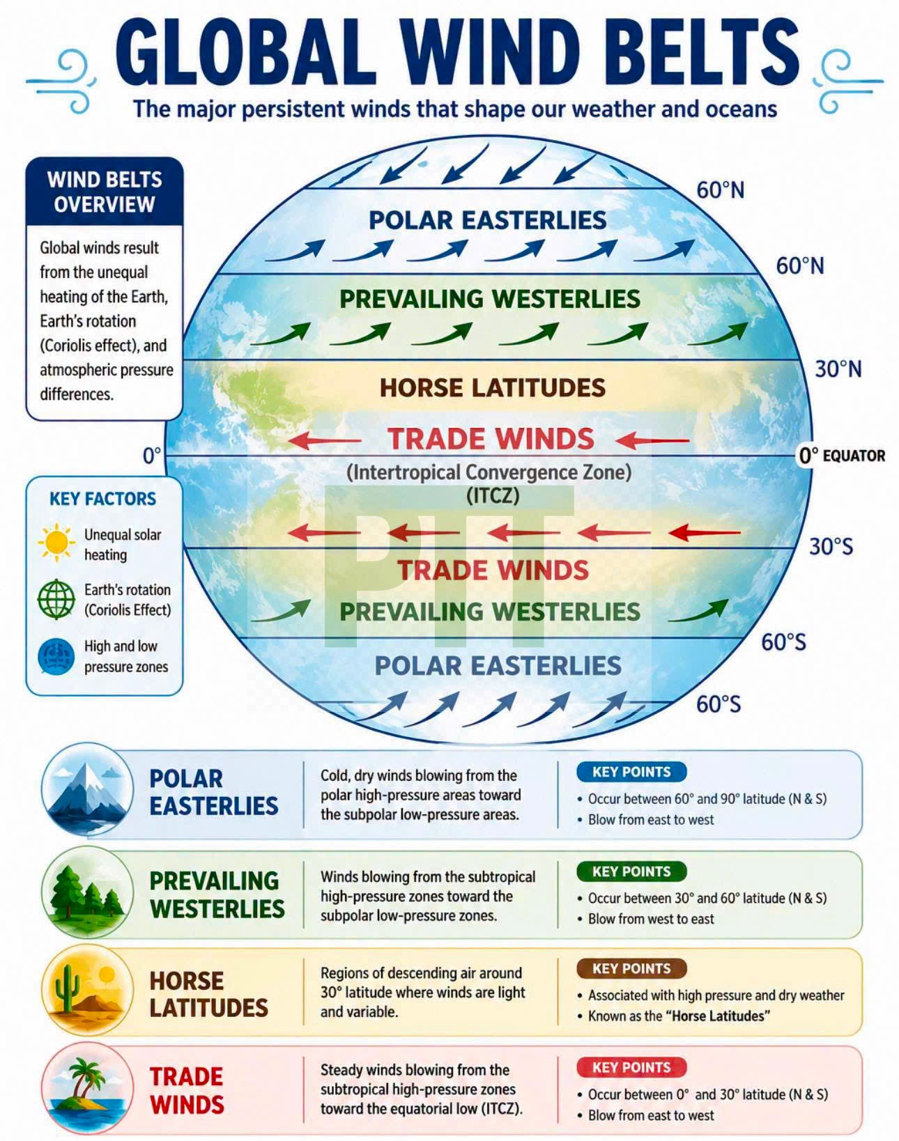
Global Wind Belts – Basic Things To Know ✅⚓️
Global Wind Belts are large-scale wind patterns created by the uneven heating of the Earth, the Earth’s rotation (Coriolis Effect), and differences in air pressure. These winds play a vital role in influencing weather, climate, ocean currents, and maritime navigation.
1. Polar Easterlies (60°–90° N & S)
- Cold, dry winds originating from the polar high-pressure regions.
- Blow from east to west toward subpolar low-pressure areas.
- Common in polar regions and contribute to cold weather conditions.
2. Prevailing Westerlies (30°–60° N & S)
- Blow from west to east between the subtropical high-pressure and subpolar low-pressure zones.
- These winds dominate the mid-latitudes and strongly influence weather systems and ocean currents.
- They are important for vessels sailing across the North Atlantic and North Pacific.
3. Horse Latitudes (Around 30° N & S)
- Regions of high atmospheric pressure where air descends.
- Characterized by light winds, calm seas, and generally dry weather.
- Historically, sailing ships were often delayed in these calm conditions.
4. Trade Winds (0°–30° N & S)
- Steady winds blowing from east to west toward the Equator.
- Northeast Trade Winds occur in the Northern Hemisphere, while Southeast Trade Winds occur in the Southern Hemisphere.
- They are reliable winds that have been used for centuries in ocean navigation.
5. Intertropical Convergence Zone (ITCZ)
- A low-pressure belt near the Equator where the northeast and southeast trade winds meet.
- Characterized by rising warm, moist air, resulting in heavy rainfall, thunderstorms, and variable winds known as the doldrums.
- Mariners often experience squalls, reduced visibility, and unpredictable weather when crossing the ITCZ.
Key Takeaway
Understanding global wind belts helps mariners plan routes, predict weather conditions, improve fuel efficiency, and ensure safer navigation across the world’s oceans.